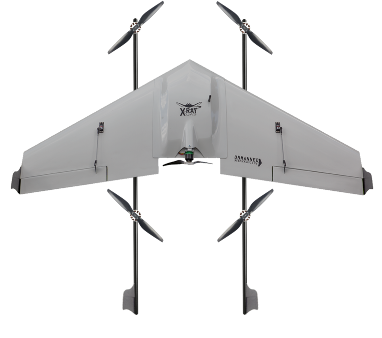
XRay® VT UAS
Versatile VTOL Mapping and Surveying for Challenging Environments
The XRay® VT fixed-wing drone, a cutting-edge VTOL variant of the XRay® UAS platform, is designed to deliver precision aerial mapping and surveying across diverse industries such as construction, agriculture, and environmental management. With its VTOL capabilities, the XRay® VT offers unparalleled versatility and performance, enabling operations in areas with limited takeoff and landing spaces, reduced wear and tear on the aircraft, and a range of applications that surpass traditional fixed-wing UAS solutions.
Efficient and accurate aerial mapping and surveying are vital for industries like construction, agriculture, and environmental management. The XRay® VT fixed-wing drone offers a powerful and versatile solution, integrating VTOL capabilities for enhanced performance and flexibility in challenging environments.
Key Features
Vertical Takeoff and Landing (VTOL) Capabilities
The XRay® VT UAS incorporates VTOL functionality, allowing for operations in areas with limited space for takeoffs and landings, providing unparalleled access to challenging and remote locations.
Reduced Aircraft Wear and Tear
The VTOL capabilities of the XRay® VT reduce the stress and impact on the aircraft during takeoff and landing, resulting in less maintenance and a longer service life.
Advanced Mapping and Surveying in Challenging Environments
The XRay® VT’s unique features make it an ideal solution for mapping and surveying in areas where traditional fixed-wing UAS platforms face limitations, offering greater operational possibilities.
Benefits of VTOL Capabilities
Enhanced Operational Flexibility
The VTOL capabilities of the XRay® VT allow for seamless transitions between hovering and forward flight, increasing operational flexibility and enabling rapid deployment and data collection in various scenarios.
Improved Safety and Precision
By eliminating the need for runway takeoffs and landings, the XRay® VT ensures safer operations and more accurate data collection, minimizing risks associated with conventional fixed-wing UAS.
Access to Remote and Inaccessible Areas
The XRay® VT can easily operate in environments with limited takeoff and landing spaces, providing access to remote and inaccessible areas for mapping and surveying missions.
With increased versatility, precision, and durability, the XRay® VT enables organizations to overcome operational challenges and stay ahead of the competition in the dynamic field of aerial surveying and mapping. By choosing the XRay® VT, professionals can unlock new opportunities and achieve unparalleled success in their missions, even in the most demanding environments.
| Wingspan | 64 in / 162 cm |
| Overall length | 52 in / 132 cm |
| Weight (lbs) | 9 empty / 13 takeoff |
| Cruise airspeed | 30-38 knots |
| Max operating wind | 35 mph |
| Flight endurance | Up to 75 mins |
| Power source | Lithium polymer |
Applications
The XRay® VT UAS is suitable for a wide range of aerial mapping and surveying applications, including but not limited to:
- Topographic and volumetric surveys for construction projects
- Agricultural land management and crop health analysis
- Environmental impact assessments and habitat monitoring
- Infrastructure inspection and monitoring
- Natural resource exploration and management