UAS Mapping and Surveying: Revolutionizing Geospatial Data Collection
Fixed-wing UAS, such as the XRay® offered by Unmanned Aeronautics, have emerged as a game-changing technology in the field of large-scale surveying. These powerful unmanned aerial systems provide numerous advantages over traditional land-based methods, enabling faster, more cost-effective, and accurate data collection. Flying surveys autonomously, fixed-wing UAS streamline the surveying process and deliver efficient results.
Increased Efficiency and Reduced Costs: Fixed-wing UAS can work up to five times faster than land-based surveying methods, significantly reducing field time and associated costs. The autonomous flight capabilities of these UAS allow them to efficiently cover large areas, minimizing the need for manual intervention. Requiring less manpower, these UAS deliver survey results more quickly and at a lower cost compared to traditional techniques.
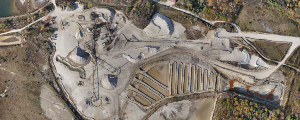
Accurate and Comprehensive Data: Fixed-wing UAS provide precise and exhaustive data that can be represented in various formats, such as orthomosaics, point clouds, and digital elevation models. Each pixel of the produced map or point of the 3D model contains 3D geo-data, ensuring detailed and accurate survey results. This comprehensive data helps professionals make well-informed decisions based on reliable information.
Access to Inaccessible Areas: Drones enable survey teams to map otherwise unreachable areas, such as steep slopes, harsh terrain, or hazardous locations. With their ability to fly autonomously, fixed-wing UAS can navigate challenging environments, capturing data without putting personnel at risk. This makes fixed-wing UAS an ideal solution for surveying projects in difficult-to-reach or dangerous areas.
High-Quality Aerial Imaging: Fixed-wing UAS excel at capturing high-quality aerial photographs and videos, collecting vast amounts of imaging data in the process. Equipped with advanced sensors and cameras, these UAS can capture images at various resolutions and wavelengths, providing surveyors with valuable insights into the surveyed area. This aerial perspective enables a comprehensive understanding of the project site, enhancing overall project planning and execution.
Improved Health and Safety: The use of fixed-wing UAS reduces the risk to the health and safety of survey personnel. By eliminating the need for individuals to work at height or in hazardous conditions, drones help prevent accidents and ensure a safer working environment for survey teams. Moreover, the autonomous flight capabilities of fixed-wing UAS further reduce the potential for human error during survey operations, contributing to a safer and more efficient survey process.
Impressive Coverage and Advanced Capabilities: The XRay® fixed-wing UAS boasts an impressive coverage capacity, with the ability to survey up to 1,000 acres per flight. This extensive coverage range makes it particularly suitable for large-scale surveying projects that require efficient data collection over vast areas.
In addition, the XRay® is designed to accommodate multiple sensors, such as high-resolution cameras, and multispectral imagers which allows it to capture various types of data simultaneously. This versatility enables surveyors to gather comprehensive information about the project site in a single flight, further increasing efficiency and reducing overall survey time.
Moreover, the XRay® can be equipped with RTK GNSS technology, which significantly enhances the accuracy of its geo-referenced data. By incorporating real-time kinematic (RTK) positioning, the XRay® achieves centimeter-level precision in its survey data, ensuring highly detailed and accurate results for a wide range of surveying applications.
The XRay’s ability to cover large areas in a single flight, its capacity to carry multiple sensors, and its integration of RTK GNSS technology make it a powerful and versatile tool for modern surveying professionals, delivering exceptional performance in various surveying scenarios.
Incorporating fixed-wing UAS in large-scale surveying projects offers numerous benefits, including increased efficiency, reduced costs, accurate data collection, and improved safety. Unmanned Aeronautics’ innovative solutions, such as the XRay® and GhostRay®, provide the advanced capabilities required to meet the demands of modern surveying challenges, delivering reliable performance and actionable data for a wide range of applications. By leveraging these cutting-edge technologies, professionals can gain a competitive advantage in today’s fast-paced surveying industry.